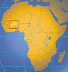
Technically speaking, my last activity at site was my big Girls' Camp with all of the other Peace Corps Volunteers in my region helping out. But I've been wanting to do this one activity for quite some time. The Volunteer before me did a World Map, so I figured why not do a map of Burkina Faso to help people better understand the geography of their own country (many times, I feel like I know the geography of the world better than the geography of the U.S....true and sad story).
It really started in February 2011 when Ali and I started to trace out a huge square on the primary school wall to make a Burkina Faso map. Since everything was coming out of my pocket, I didn't have the money to pay someone to cement the wall and flatten it out. So Ali and I used a daba (farming tool used by hand to till the soil) to scrap the wall until it resembled something flat and easy to paint on...then days passed, followed by weeks, which turned into months. Everyday, I'd pass by and think to myself, "Man, I really need to get this started. Ehh, maybe tomorrow when it's not so hot (or some other excuse)."
Ali and Hercules chilling by the now-scraped wall at the side of the school.
June and July quickly approached and my neighbors would keep asking when I would finish it. I told them I would never, ever leave and not to finish it. A promise is a promise, right? But also, I knew that I needed to just do it and stop procrastinating. Also, I had such a limited time frame to paint it. I could only paint in the mornings until 12:00pm because the sun would hit the wall after that time, making it unbearable to paint with the African sun beating on you. Also, rainy season was approaching, making it virtually unpredictable to guess what the weather would be that day.
Needless to say, procrastination/time moving rapidly toward my departure got the best of me and within less than two weeks, I was able to complete this (of course, with the help of Ali and his friend Franck)!
Ali and I painting the surface white first.
Perhaps one of the hardest parts of creating a grid to properly draw the map -- partially because I'm a perfectionist and wanted all the lines to be as straight as possible. I already had a drawing on a piece of paper with the grid, so it was much easier to draw (and a lot of fun, actually)!

Franck, Ali's friend, has a knack for drawing, so I made him do the Peace Corps logo at the corner.
Then I outlined Burkina Faso itself in paint to ensure less mess when painting.

This picture is so indicative of how many people came to watch. At first, it was kind of annoying because I just wanted to work without a dozen people staring at my every move from behind. But in the end, I actually started to appreciate it. I could see students (and adults even) start to see the map start to take form and I could start to see little lightbulbs turning on. Amazing!

Because the map was so close to my house, Grace would walk over all the time, mumble something and tried to keep touching the map. Loves it!

He's so good at drawing!
Almost done! I'd just like to note how unstable that ladder was. While I wanted to get this map done, I also didn't want to break any bones before leaving.

Peace Corps! With the names of the people who created it below.
The finished product with my two helpers, Ali and Franck. Couldn't have done this without them!!


Pointing to where I live in Burkina Faso.

I hope this map stays for years to come. I figure teachers in the schools around Kampti can use it as a guide for their students when it comes to geography lessons. And it's pretty huge: 8' x 11'! It also initiated a lot of good dialogue between community members, students and myself. It was also a great way of saying farewell to Kampti and to the many people that have made my experience in Burkina Faso so pleasant. Until next time!


No comments:
Post a Comment